Been a bit busy with life to sit down and write down this trip report but since I’m sitting on the couch with my injured leg elevated, I figured I should put fingers to keyboard.
the team at BC
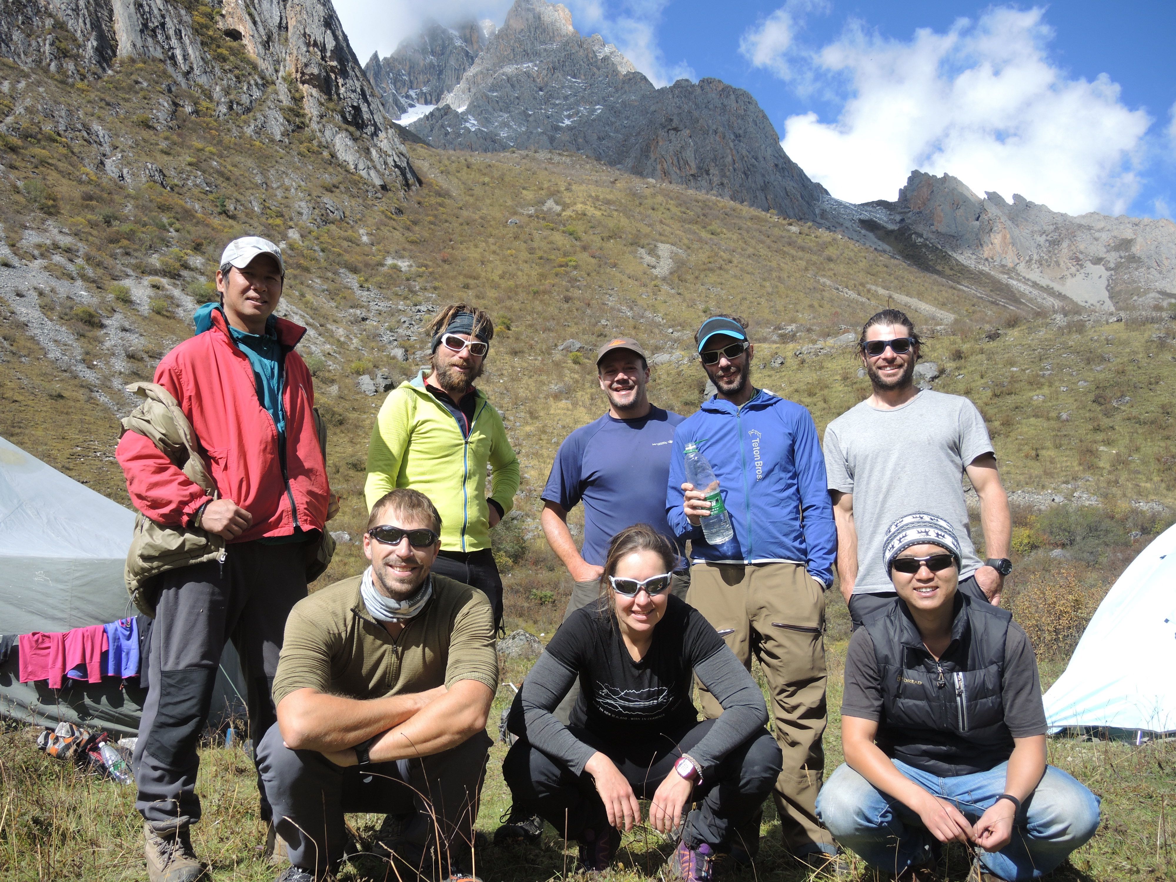
This trip to a remote and rarely visited part of China came a bit out of blue with an offer from a good mate in mid 2014. It didn’t take long to say yes when I received Ed’s email with a few distant photos of a cool looking peak. Our Australian-Austrian team consisted of Ed Hannam (trip leader and organiser), Dan DaSilva, Paul Niel, Gerald Boess and Judith Fall and myself (lead climber). We were also joined on the trip by our translator and assistance cook Alex and Pan, the liaison officer assigned to our team who also doubled as our amazing cook. The food on the expedition as by far the best I’ve had on any expedition with excellent Sichuan food on the menu every day.
The mountain we would be trying is the most prominent peak of the Gangga Central Massif in North Western Sichuan, China. The Gangga Massif is in close proximity to the Kawaori Massive and the Yalong River valley and is totally unclimbed and virtually unexplored. The mountain is designated Gangga VII in Tomatsu Nakamura’s (famous Japanese explorer) maps so that is the name I’ll use.
In September 2014, our team of 6 met in Chengdu, China and after a few days of shopping, preparation and the obligatory visit to the Panda sanctuary, we boarded our small van and headed in the direction of Eastern Tibet.
Armed only with distant photos of the peak and some GPS coordinates, the team travelled 2 days from Chengdu, China to Ganzi Town (altitude 3500m, GPS coord: 31.624125, 99.989959) in North Western Sichuan Province. The proximity of the area to the Tibetan and Qinghai borders has caused significant travel restrictions in the area with special permits required for access. The drive to Ganzi was an education in itself with mountains, huge gorges and cities all forming part of the landscape. Foreign tourists are not that common in these areas.
The mountain was about 30km from the town, which allowed us to scope out possible routes and locations for base camp on a day trip from town. We explored the northern and southern aspects of the mountain and found a perfect base camp location with a grassy meadow and spring water nearby.
The final days of the Asian monsoon created some havoc for us weather-wise during the first week but allowed us enough time to put in a high camp at 4500m, about 500m from the base of the ‘real’ climbing. High camp was in a large cwm ringed by +5200m peaks and walls, on a vast plain of scree. I shared a small tent with Paul while the 2 chaps (Ed and Dan) shared the “Brewhouse”. Judith and Gerald occupied the 3rd tent. The tent space was limited at high camp and there was no ready supply of water so we didn’t hang out there for extended periods, preferring instead to drop back to base camp for a rest when needed.
The mountain ended up being much more complex than first thought with hidden ridges and gullies making up a very challenging three-dimensional mountain. The rock on the mountain was predominantly limestone, some bullet hard and some brittle and flaky.
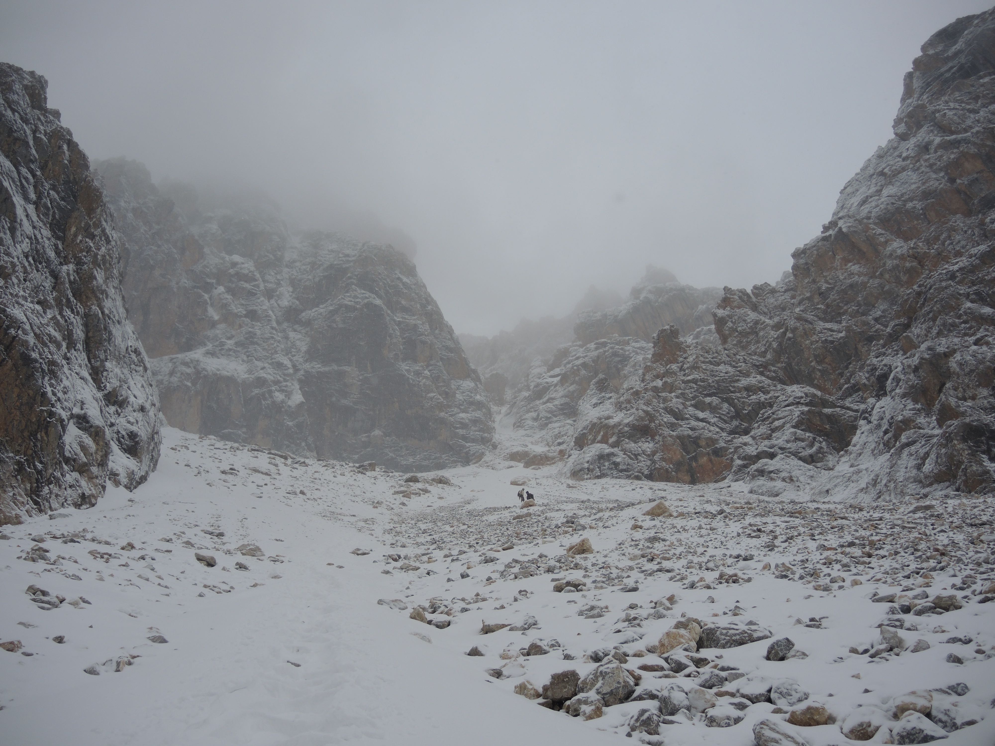
The first route we chose to attempt was a seemingly obvious gully of snow slopes connected by ice and rock steps that wound from the south-east around to the northern side of the mountain. On the first attempt, we started from base camp making it a long day. A 500m approach on scree from high camp led into the first pitches, which were mostly rock. The gully became more snow-filled and icy as it got higher, narrower and turned towards the northern aspect, and therefore colder. At each belay I fixed the anchors so they would be ready for the descent. The gear consisted of small wires hammered into the thin cracks and pitons. At pitch 7, we encountered steep, shitty and unprotectable ice. After a couple of frustrating attempts, we decided to bail and we all headed down into the storm and darkness reaching high camp around midnight.

After a few days rest in base camp, we decided to attempt a rock route on the sunnier south face. After 2 pitches, the sun hit the upper face and caused the rocks from above to start pinging down making it seriously dangerous to continue, especially for the team below who were attempting to ascend the fixed rope. For the second time, we bailed back to camp. A team of 2-3 with rock shoes could likely ascend the face quickly (6-8 pitches) but the route from the ridge was hidden and uncertain.
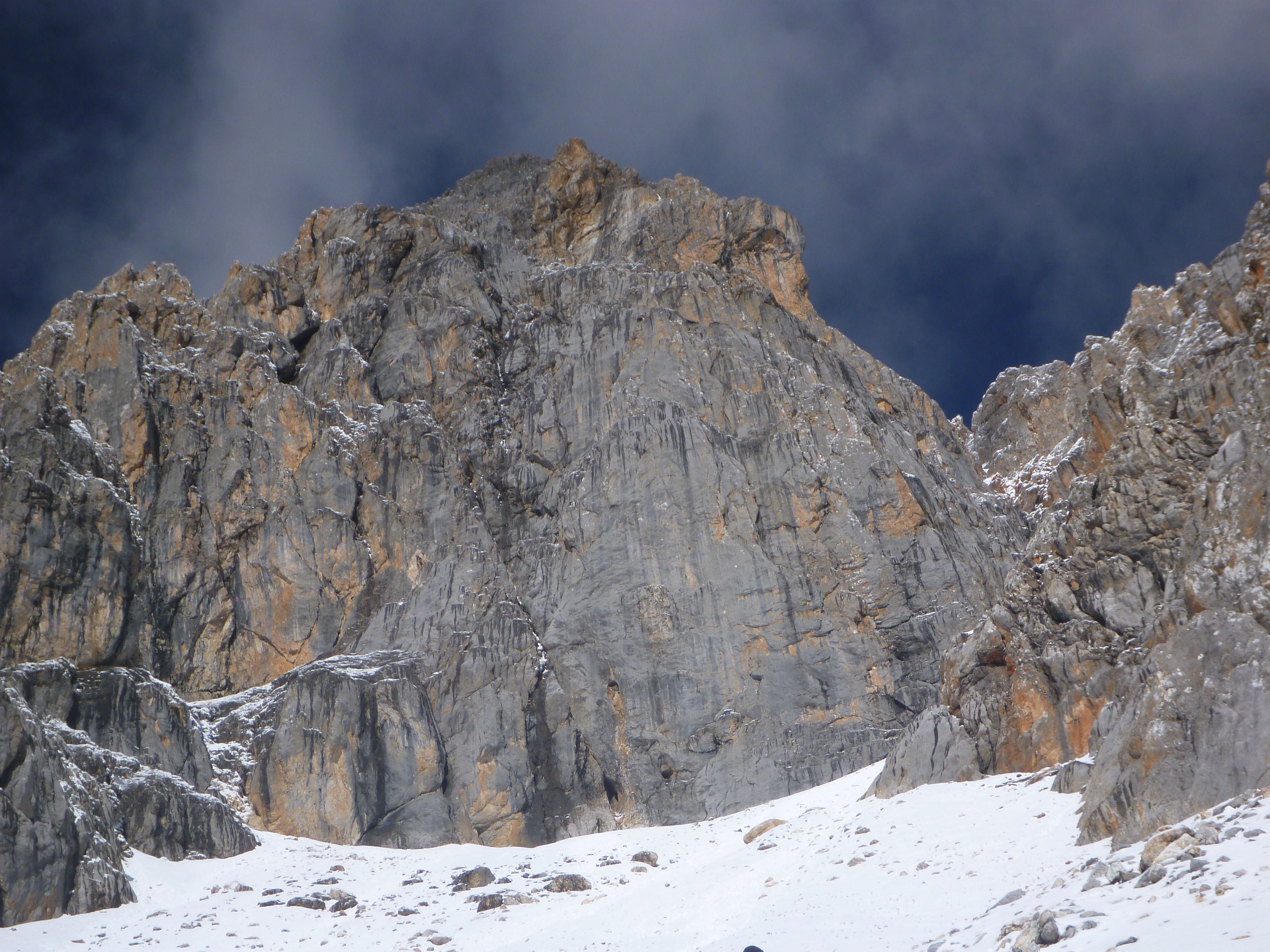
South face of Gangga VII. Couloir is the faint curving line on the right
We seemed to be running out of ideas so we scouted out the northern aspect, only to find it even more complex with deeper couloirs, but off limits due to a construction project and a gold mine.
We decided to return to the first route we tried, choosing this on the back of a weather change that had turned much colder and clearer. This time we left from high camp and had a lot of the anchors in place. The approach was much faster as were the initial pitches, as now hard snow covered what was before exposed and sometimes loose rock. This meant we could simul-climb what previously needed jugging and some mixed sections were now entirely ice and neve. We reached our earlier high point at about midday to find things were still very steep but with better quality ice making for more positive tool placements but still not much in the way of protection.
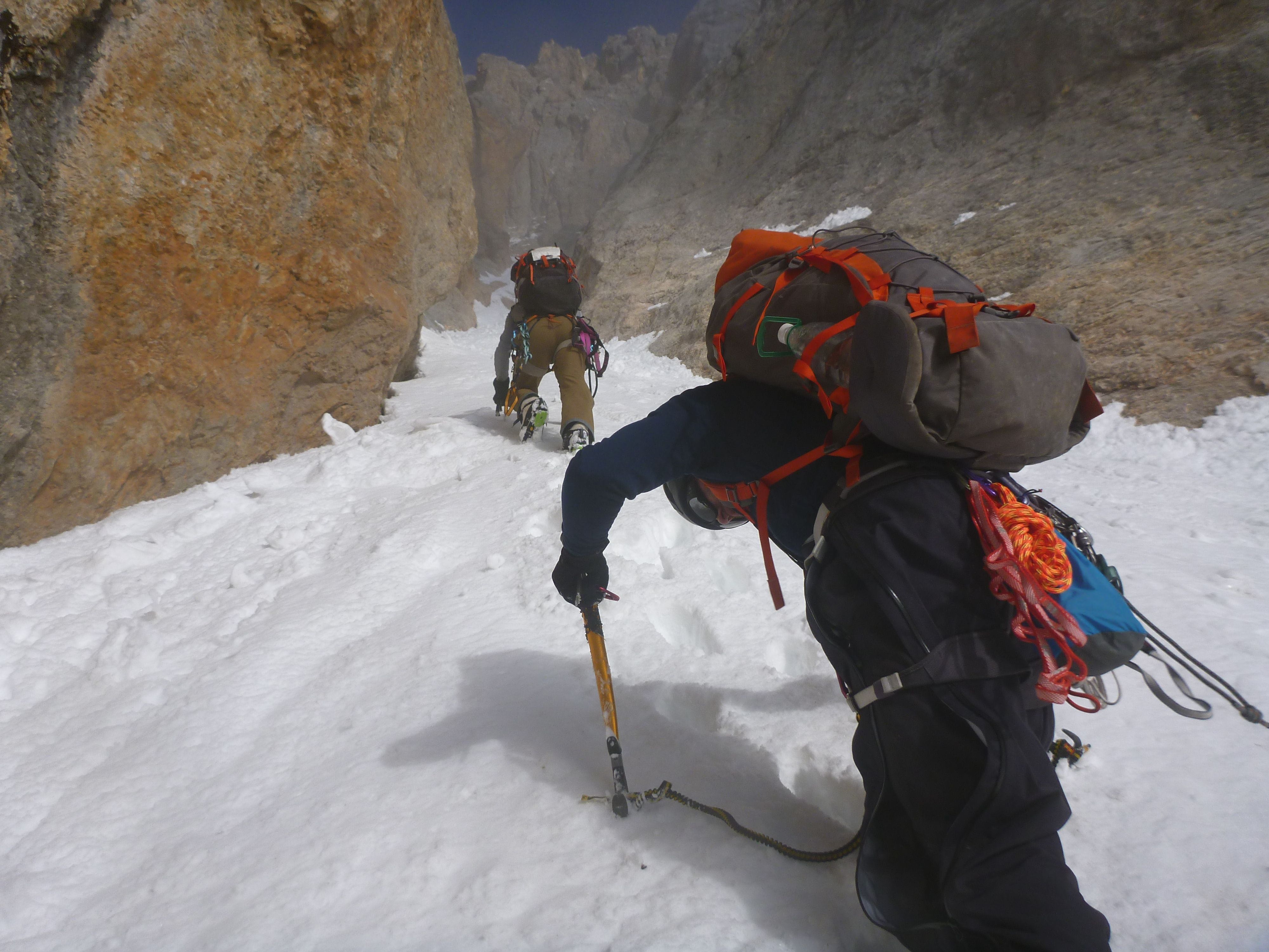
Heading up the couloir on our 2nd attempt

The next 2 pitches were some of the scariest and thinnest climbing I had ever done and it was quite draining at over 5000m. At the end of pitch 10, we came to a long overhanging chimney of thin ice that looked pretty desperate. Ed and I agreed that the right decision was to descend. The rock was loose and it was getting late. These factors compounded by being a large group made the decision for us. 30 minutes after beginning the descent, a severe storm hit the mountain causing high volume avalanches to cascade down the route making the descent rather exciting and a little tedious. Insane amounts of spindrift were being channeled into the couloir from several sides of the peak and a trickle of cascading snow became thigh deep faster than expected, made worse as the narrow gully we were descending went thru a series of bottlenecks. I was leading the way down, rechecking the anchors I had placed on the way up. We eventually made it down to high camp and dropped into our tents to eat and sleep.
Overall with two separate attempts over a week, we managed to climb 10 new pitches (500m) up the condition-dependent SE couloir before being stopped by weather, bad rock and difficulties. Pitches 7 and 8 were the crux pitches (Scottish V+) with very thin, exposed and steep ice steps (see topo). A height of 5340m was reached on the SE couloir before turning around. All pitches were 50-60m long with scarce protection consisting mostly of knifeblade pitons and hammered-in small wires.
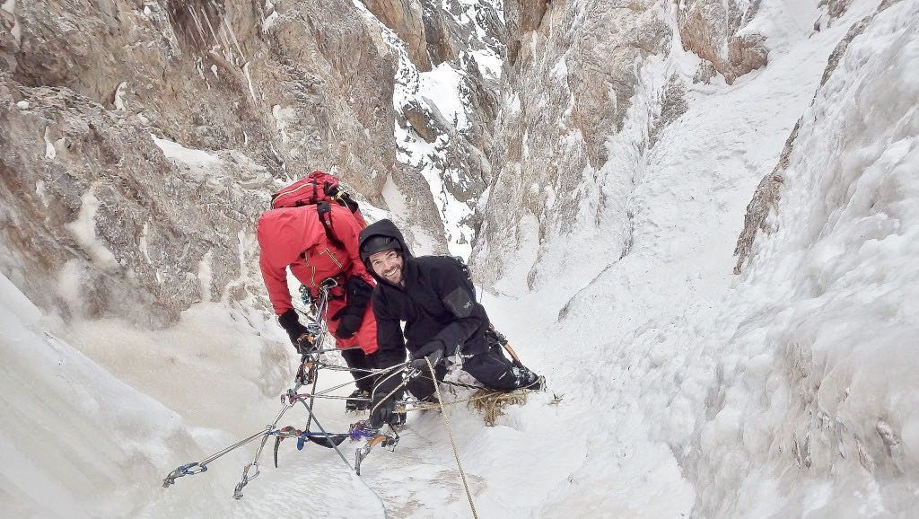
Dan and Ed at the belay high in the couloir

high point in the SE couloir. overhanging chimney is evident above

Spindrift avalanche sweeping down the route

Ed following a pitch high in the couloir
Descending in the storm after the 2nd attempt on the couloir
We had run out of time and it was time to head home. The last days were spent deconstructing BC and a recon trip further down the valley where we checked out some awesome possibilities for future trips.
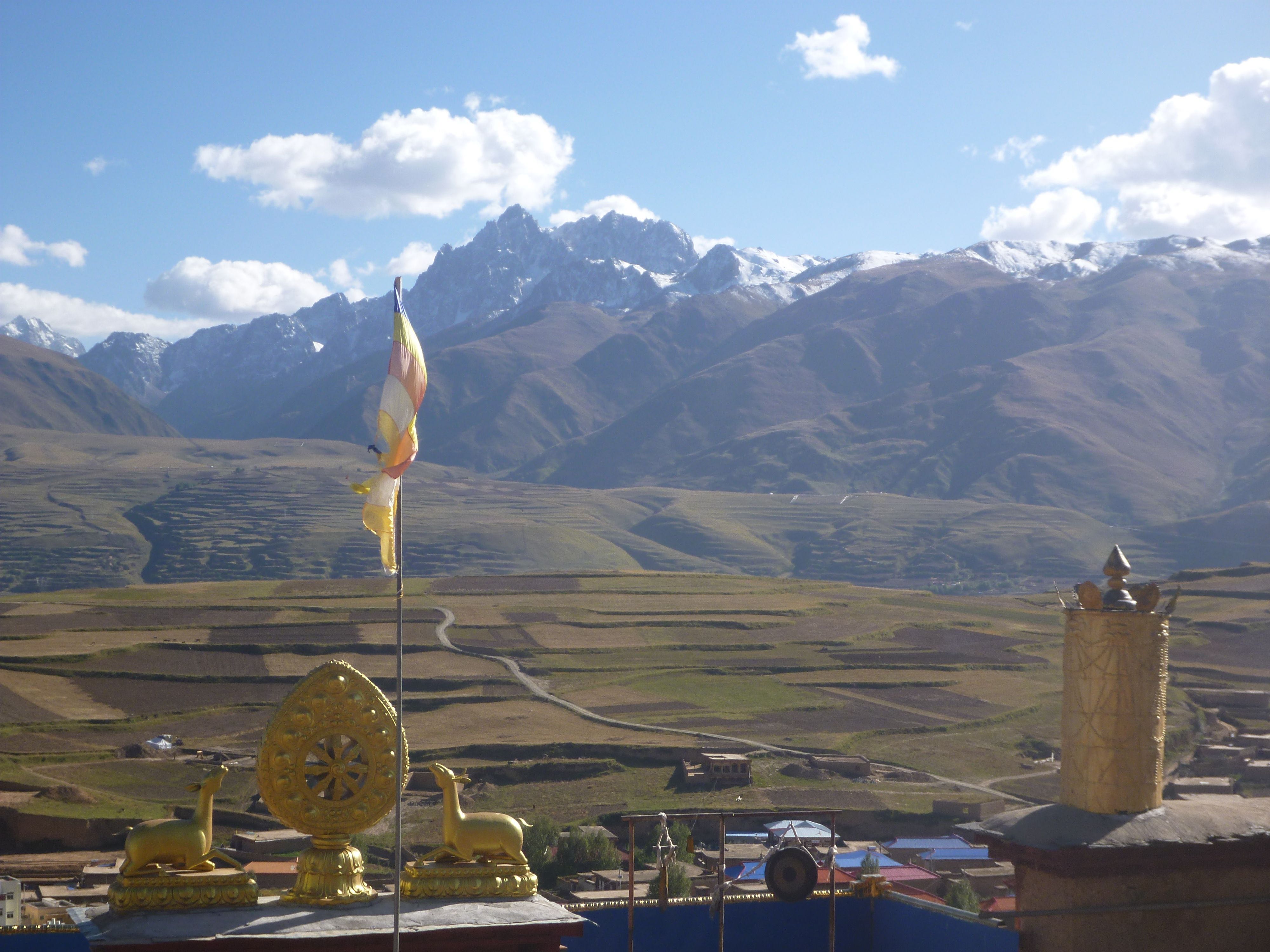
View of the Gangga Massive from Ganzi Monastery
This was my second trip to China/Tibet (the other being to Cho Oyu in 2008). It was a fantastic opportunity to explore and experience a rarely visited part of China and try to climb an unclimbed peak. With no chance of helicopter rescue and being a long way from any help, we had to be self-sufficient and operate within a solid margin of safety. We made some good progress up a very challenging peak and got everyone home safely.
References
http://jac.or.jp/english/images/vol14/JAPANESE%20ALPINE%20NEWS%20Vol14-11.pdf
http://www.jac.or.jp/english/kiroku/Untrodden.pdf
http://www.alpinist.com/doc/web10s/wfeature-nakamura-sichuan-unclimbed-peaks
http://jac.or.jp/english/images/JAPANESE%20ALPINE%20NEWS%20Vol14_0.pdf
